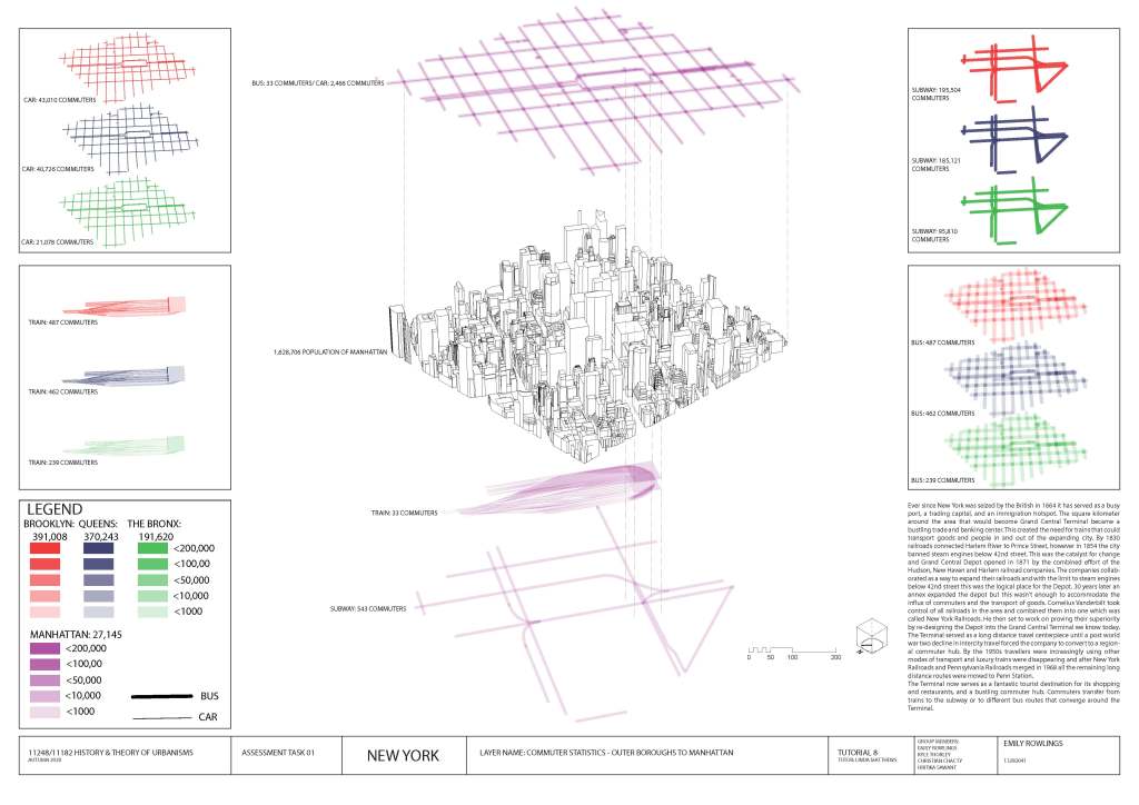
Assessment 1 required us as a group to map a 1km square of New York City. We chose the area around Grand Central Terminal to better understand how this once bustling center of trade and goods became the tourist hot-spot and shopping precinct it is now know as. Through research of roads, trade routes, and public transport we created a map that details commuter statistics into the Manhattan borough. Which as we discovered displays that over time the Grand Central Terminal was downgraded to the tourist hub rather than the commuter hub.
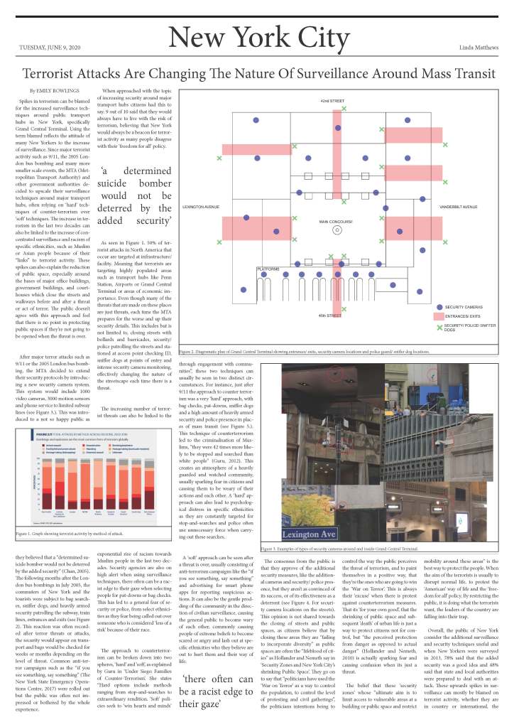
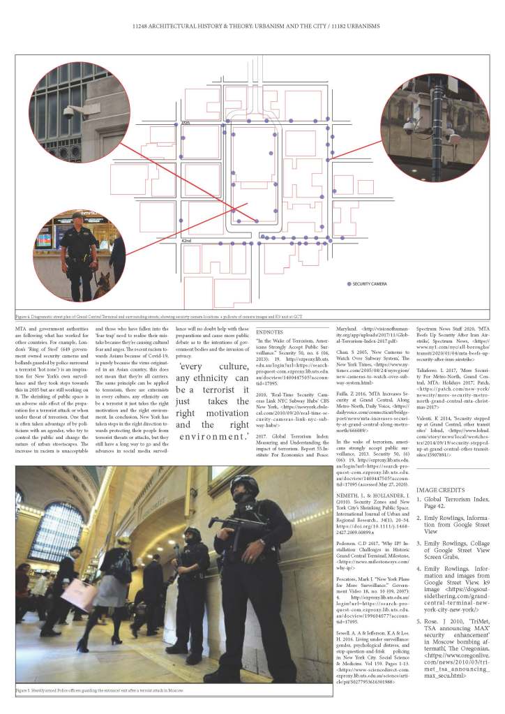
Assessment 2 required us to take our research from Assessment 1 and bring in the element of surveillance. By mapping the location of cameras in and around Grand Central Terminal and researching surveillance techniques before terrorist attacks I was able to evaluate how the increase of surveillance effected mass transit and the surrounding city. These spikes in terrorism can also explain the reduction of public space, especially around the bases of major office buildings, government buildings, and courthouses. Security agencies are also on high alert when using surveillance techniques, there often can be a racist edge to their gaze when selecting people for pat-downs or bag checks. Hence the increase of survaillence around mass transit has a negative impact on the public and creates hesitation when introducing new public space into a city for fear of terror attacks.
See below for full article, statistics and images.